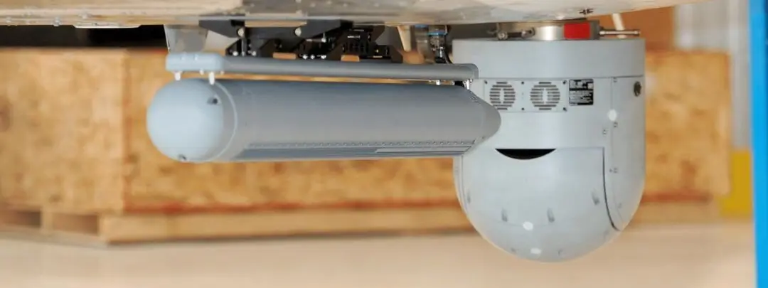
UAVs
- EO/IR, SAR radar, LiDAR, SIGINT
- Radar payloads from 3 kg (OEM data)
- UAS Groups 2 to 5
- NATO AQAP 2110
Get more mission out of your unmanned aircraft. AIR TEAM Intel integrates the payload, datalink, ground workstation and navigation on military UAS, sized to the weight, power and space the platform really has.
Mission profiles
Surveillance and reconnaissance
EO/IR imagery and thermal data by day and night, and SAR radar through cloud, foliage and darkness.
Search and rescue
Thermal imaging, LiDAR and phone detection to locate people in difficult terrain.
Mapping and survey
Laser scanners for 3D terrain models and EO cameras for photogrammetry.
Infrastructure inspection
EO/IR, LiDAR and radar measurements of powerlines, pipelines and critical assets.
Sensors and systems
Each payload is chosen against the size, weight and power of the airframe. The OEM names are examples of the classes we integrate.
EO/IR payloads
Gyro-stabilised day and night cameras for identification and tracking.
SAR / GMTI radar
IMSAR NSP-3, NSP-5 and NSP-7 class radars, matched to the UAS group.
Laser scanners
RIEGL miniVUX-3UAV class LiDAR for mapping and inspection.
Signals payloads
Phone detection and satellite-phone monitoring in UAS-sized packages.
Datalink and recording
Encrypted line-of-sight link to the ground station, with onboard recording when the link drops.
Ground control and navigation
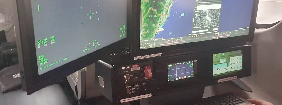
Remote control workstations with live sensor feeds and tactical overlays, and autonomous navigation that needs minimal human intervention.
Proven in service
GOSHAWK: a complete ISR aircraft on the Tecnam P2012
The payloads, mission control and datalinks we integrate on UAS are the same families we certified on GOSHAWK, a manned ISR aircraft with SAR radar, EO/IR, AIS and a 150 km downlink. The IMSAR NSP-7 it flies is also built for Group 4 to 5 unmanned platforms.
Key specifications
Radar payloads by UAS group (OEM data)
- IMSAR NSP-3, Group 2 to 3
- 3.04 kg, 81 W, 0.3 to 1 m resolution, SAR 16 km, maritime 192 km, MMTI tracking 75 km
- IMSAR NSP-5, Group 3 to 4
- 7.5 kg, 130 W at 28 VDC, maritime 259 km, 5,300 NM²/h at 80 KTAS
- IMSAR NSP-7, Group 4 to 5
- Ku-band, up to 300 W, maritime beyond 340 km, SAR 55 km, 17,100 NM²/h at 150 KTAS
Other payload examples (OEM data)
- Phone detection
- Smith Myers ARTEMIS C-A: 0.56 kg, 5 km, for UAS pod mounting; Lifeseeker class for manned and unmanned aircraft
- Satellite phone monitoring
- BLACKFISH class, built for manned and unmanned aircraft: Iridium, Thuraya, IsatPhone Pro
- LiDAR
- RIEGL miniVUX-3UAV
Certification and support
Interfaces and power
Electrical budget, structural attachment and data interfaces planned on the actual platform.
Lab and ground testing
Payload, datalink and navigation tested together on the ground. Our avionics lab has environmental test chambers.
Flight test and approval
Flight test and approved data from AIR TEAM Engineering where the programme needs it.
Training and support
Operator training on payload and ground station, then maintenance and upgrades.
AIR TEAM Engineering designs the change under EASA design approval EASA.21J.849. AIR TEAM service installs and maintains it at Kunovice (LKKU) under EASA Part-145 CZ.145.0094 and Military Part-145 CZE.145.1004, and manufactures parts under POA CZ.21G.0075. Defence quality management is certified to NATO AQAP 2110, the quality system to ISO 9001:2015. ITAR and military trade licences are in place. All approvals →
Planning a mission-system programme?
Tell us the platform and the mission. We reply within 1 business day.