Rating value is 0 of 5
AirGizmos
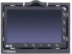
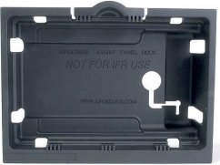
EKP IV/IV Pro panel dokkoló
Általában 3 hét
74 017,51 Ft
58 281,50 Ft ÁFA (VAT) nélkül
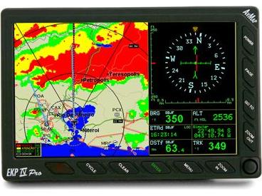
With the same design and software as the EKP IV, the EKP IV Pro is the professional version designed to provide special software features and data sets.
Choose from three pre-set patterns that draw the SAR pattern selected at the push of a key.
See you aircrafts track on the display and easily monitor your movement along the SAR pattern. Download track and SAR pattern for post-ops training. You may choose among three patterns. EXPANDING SQUARE, CREEPING LINE AHEAD and CIRCULAR.
The Compact Flash is preloaded with Jeppesen data of Europe + Africa and the terrestrial Tele Atlas maps of Europe!
An advanced feature of the EKP IV Pro is the ability to access the detailed Tele Atlas street data. The Search function allows the operator to instantly navigate to the desired address. You can search for a place or street entering State, Country, Town and street name.
The EKP IV Pro may be connected directly to Telefix, a localization system for fleet management and or Kenwood APRS (Automatic Position Reporting System) . By means of these systems it is possible to send ones own position to a remote control center. From the control center it is possible to receive waypoints that are automatically displayed on the EKP IV Pro Screen.
| Tanúsítvány | CoC |
|---|---|
| Touch screen | No |